A very spatial software session
Meg Miller - GIS & Data Visualization Librarian
workspace: bit.ly/uml_agol
Outline
- What is GIS?
- Considerations if you are undertaking a GIS project
- Data Visualization and Campus Libraries
- ArcGIS Online (workshop)
What is GIS?
Geographic Information System
Any system used to analyze, capture or work with geospatial data.
1. What data types are used in GIS
Data Types: Textual
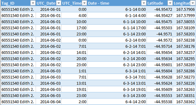
Usually open formats like .csv, geojson, ascii...)
Data Types: Vector (point, line, polygon)

Each point has an x,y (lat/long) coordinate pair associated with it (.shp, .svg, .dxf...)
Data Types: Raster
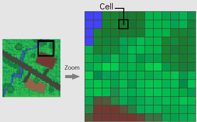
A grid made of cells/ pixels(.jpg, .tiff, .grid, .rast, .ecw…)
Data Types: APIs (Application Programming Interface)
A set of rules for how software can exchange data(local or remote, web services are a subset)
2. What types of things can we do with GIS
Popular processes:
- Digitization of historical maps/images
- Reconstruction of features from the past
- Georeferencing microdata
- Analyzing microdata to show trends and patterns.
Considerations:
3. How can Libraries support me
Library Support:
Librarian Support
Subject Guides
Training opportunities
Tool Choice
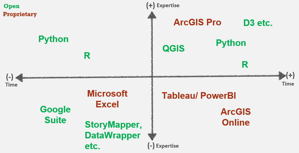
Key Points:
- Your expertise - be kind to your future self
- Purpose - exploratory vs. explanatory
- Audience - expertise, mediation
- Data requirements - size, residency, privacy...
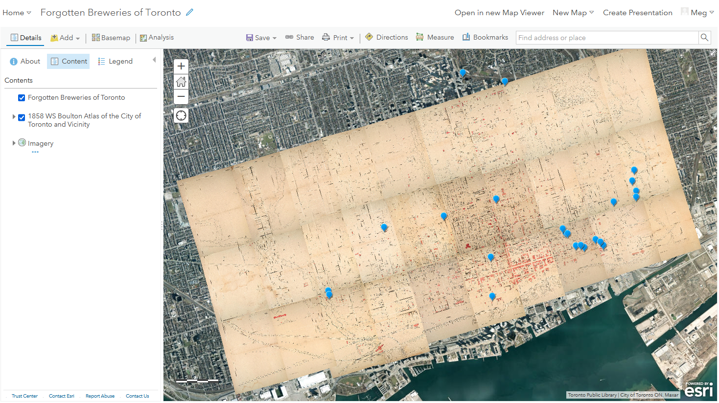
Hands-on: Exploring ArcGIS Online
Questions
meg.miller@umanitoba.ca
workspace: bit.ly/uml_agol